

GGU-STRATIG
 GGU-STRATIG
Evaluation and graphical representation of the results of ground and water boreholes, as well as further brownfield and soil investigations
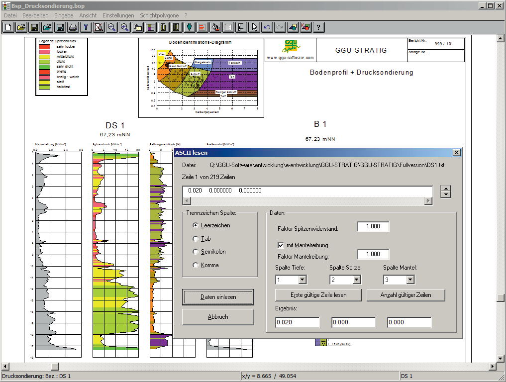
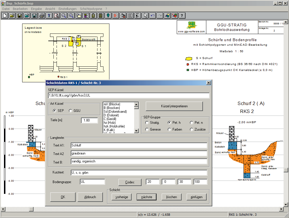

The investigation results can be visualised as:
- Stratigraphic logs to DIN 4023
- Dynamic penetration test diagrams to DIN 4094 (DPT)
- Well casings
- Multiple gauges
- Cone penetration test diagrams (CPT)
- Measured data diagrams
- Table diagrams
- Inclinometer diagrams
Capabilities:
- Data transfer to GGU-BORELOG (= once-only data input)
- Abbreviated stratigraphic data input using SEP 2 or user-definable codes
- Import and generate LBEG (Landesamt für Bergbau, Energie und Geologie, formerly NLfB) Hannover SEP 2 data format
- Coloured soil column output and integration of user-definable bitmaps for any kind of "hatching"
- Soil group output to DIN 18196
- ASCII interface for importing dynamic penetration test data and CPT results
- Colour-coordinated evaluation of DPTs taking groundwater into consideration, e.g. for displaying relative density
- CPT evaluation with colour-coordination for cone resistance and friction ratio (= automatic soil profiles)
- CPTs with automatic visualisation of the constrained modulus
- Visualisation of well casings and multiple gauges
- Measured data diagrams as bar or line charts, with linear or logarithmic divisions, e.g. for depth-oriented visualisation of water content
- Depth-oriented table graphics, e.g. for visualising soil properties
- Table of extraction capacities to VDI 4640
- Visualisation of inclinometer measurements
- Creates strata polygons, e.g. for visualising geological sections
- Visualisation of reference staffs and horizontal reference lines
- Integrate numerous graphics formats
- Height displacement input (2 profiles above one another on a single sheet)
- Statistics functions for invoicing boreholes and dynamic penetration tests
- User-designed output sheet
- Print or copy screen sections, e.g. for transfer to a word processor
- Integrated Mini-CAD system for additional annotation of graphics
Current updates & changes
13.10 (23.09.2026)
- Bug: Subsoil layer column overlaps the soil groups in the borehole profile
- Bug: Width of the expansion cannot be entered because the close button covers the field
- Bug: Long text box covers the backfill when it extends deeper than the layers (Manual)
- Bug: Table contents shift when saving and copying if cells contain line breaks
- Bug: Layer directory under the borehole overlaps the layer descriptions with many narrow layers at the end of the borehole (Manual)
- Bug: Groundwater monitoring stations are additionally displayed as well construction during SEP3 import. (Manual)
- Bug: Multiline placeholder contents from GGU-CONNECT no longer cause a program crash in MiniCAD (Manual)
- Feature: Y scale from the template must be retained during CONNECT import (e.g., 1:100) (Manual)
13.9 (14.08.2026)
- Bug: Homogeneous area layer cannot be imported
- Bug: Second line in the text below the borehole profile is drawn above the first (Manual)
- Feature: Make font size of subsequent lines of the exploration header adjustable (Manual)
- Bug: Groundwater monitoring stations show construction labels and color signatures again after SEP3 import (Manual)
13.8 (21.07.2026)
- Bug: Missing comma between color and addition in the layer description
- Feature: Display the long text description box in the borehole profile wider
- Feature: /CONNECT: Bidirectionally synchronize 'Text under profile' with 'Remarks' field
13.7 (03.07.2026)
- Bug: Options for displaying backfill and construction are not saved with the file
- Bug: Groundwater level is no longer truncated on the left when opening CONNECT boreholes
- Feature: Specify the width of construction and backfill through the general settings for all
13.6 (29.06.2026)
- Bug: Layer depth is adopted when automatically generating the abbreviation line
- Bug: Depth of dynamic probing from GGU-CONNECT is displayed doubled
- Bug: Empty homogeneous area type set from CONNECT is imported as active
- Feature: GGU-CLOUD import: 'Borehole collapsed' and layer remarks are reliably adopted
Show all entries
Online-Shop:
All prices incl. VAT
Information about our licenses
Simple and secure processing!
During the further order process you switch to the store system of our technology partners "WIBU Systems" and "cleverbridge". You can find out more about these companies under the following links.
 |  |
Additional information:
System preferences
- Microsoft Windows 11
- Microsoft Windows Server 2019 or 2022
- Internet connection for download, installation, and online features
- Sufficient free disk space for installation and project data
- An available USB port when using a CmStick license dongle
Licensing Information
- CmActLicense is tied to a physical Windows PC and is not intended for use on virtual machines.
- Depending on the licensing model, CmCloud-based licensing options are available for virtual machines.
- An Internet connection is required to use CmCloud.
1x Floating Network License
1747,52 €
incl. VAT
365 days rent
- Free support
- Always current versions
- CmCloudContainer
- Supports virtual PCs
- Automatic license distribution
- Access via network/VPN
- Ends automatically
- Access for teams
1x Non-Network License
1165,01 €
incl. VAT
365 days subscription
- Free support
- Always current versions
- License binding to PC
- One program user
- Automatic renewal
- Annually cancelable
1x Floating Network License
264,00 €
incl. VAT
10h PayPerUse
- All GGU applications included
- Free support
- Always current versions
- License binding to PC, CmCloudContainer or Dongle (CmStick with serial numbers starting with 3-344xxxx)
- Access via network/VPN
- Usage time by the minute
- All programs included
- Ends automatically
- Ideal for home office and license usage spikes
Webinars & Videos

Webinar
Geotechnical Design of Earth Dams (78min)
Geotechnical Design of Earth Dams Using "State of the Art" Software
Sample Project: "Wippra"